Sunday, November 22, 2026Vol. III · No. 326Subscribe
The Mining, Energy & Technology Wire

Pipeline Maps Become the Scarce Asset

Pipeline operators are racing to put AI agents on top of their GIS. A tighter map-accuracy rulebook says the scarce thing is the survey-grade data underneath.

Pipeline Maps Become the Scarce Asset
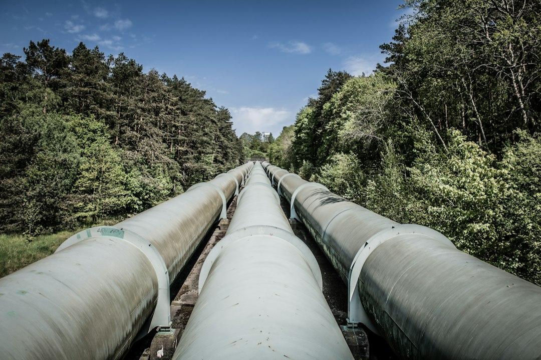
PhotographPipeline operators are racing to put AI agents on top of their GIS. A tighter map-accuracy rulebook says the scarce thing is the survey-grade data underneath.Photo: Wolfgang Weiser / Unsplash

At the 2026 Energy Resources GIS Conference, David Nemeth of Energy Transfer showed software agents working across 140,000 miles of pipe in 44 states. The agents drew on GIS records, engineering documents and live regulatory sources, according to Esri's recap of the event. It was an impressive demo. It was also a bet that the records underneath are right.

That bet is about to be tested. Pipeline compliance consultancy RCP wrote that, effective January 1, 2027, all pipeline and LNG plant data submissions must align with major new spatial accuracy and attribute field updates. The scarce asset in pipeline geospatial work is not the AI tooling, which vendors are handing out in beta. It is clean, survey-grade data, and the regulatory calendar is about to price it.

The rulebook leaves no room for shortcuts

RCP's account of the changes is blunt. Every pipeline and LNG feature must be updated, it wrote, because of extensive revisions to the underlying data architecture. Operators cannot file "No Change Notifications" or use simple addition submission types for CY26 data. Revision code "N", meaning no change to the data feature, has been disabled for the 2027 filing period, and pipeline submissions stay barred from using it through 2028.

Omissions carry their own penalty. RCP wrote that they will be treated as deletions, forcing a systemwide rebuild and re-validation of active assets. Operators must also adapt their internal GIS to new Excel attribute templates and to the ESRI shapefile and geodatabase feature class templates distributed by PHMSA.

The deadlines are fixed. Gas transmission and LNG plant operators must submit finalized geospatial datasets by March 15, 2027, and hazardous liquid operators by June 15, 2027. RCP's advice was to start auditing current GIS databases against the updated schemas immediately. Nothing in that advice involves a language model.

The tools are ahead of the data

The software side is moving fast. In a blog post dated Nov 09, 2026, Esri said it is connecting ArcGIS to agentic ecosystems through MCP (Model Context Protocol). That equips agents such as Anthropic's Claude and Microsoft Copilot Studio to find places, plan routes and query spatial data. Esri's sample query asks an agent: "which 5 assets within 0.25 miles should I inspect next? Prioritize them based on the last inspection date". MCP support is in beta now, with general availability due in the next releases of ArcGIS Location Platform and ArcGIS Enterprise.

Esri sells the platform, so read its recap with that in mind. Even so, the vendor's own conference write-up carries a warning from the customer side. ExxonMobil's Lisa Zygo was direct that the data isn't ready yet for many of the AI tools on offer, and she advised keeping foundational QA/QC processes in place. Her advice on the tools themselves was short: "Don't just trust them." The oil and gas panel named data quality and governance as prerequisites for AI.

Esri's recap also shows where the work sits. Buckeye Partners and Geonamic Systems faced inline inspection data scattered across dozens of Excel spreadsheets from different vendors, and they built a centralized platform integrated with ArcGIS. Fugro's seafloor-mapping system detected more than 500,000 boulders from side-scan sonar data. It did so inside a governance framework with formal QA/QC validation at every step. Neither project was about a smarter model. Both were about data someone could stand behind.

Sensors make more data, not better data

Drone LiDAR is the other force pushing the map toward higher fidelity. POWER Magazine reported that on Feb. 3, 2026, a Censys Sentaero 6 fixed-wing drone inspected 77.7 miles of high-voltage transmission corridor between Daytona Beach and Mims, Florida. It produced 140 gigabytes of point clouds and imagery. Automated analysis finished vegetation-clearance modeling across the full corridor in 39 minutes.

Censys's Kyle Miller put helicopter inspection at roughly $260 per mile against $61.26 for the Censys model. Censys's Matthew Davis said the solution is seen "scaling for long linear asset owners like pipeline, rail, roadways, borders, etc." Lidar News listed pipelines among the long linear assets that beyond-visual-line-of-sight flying can map efficiently. It also wrote that data volumes will rise significantly as corridor-scale capture becomes standard.

More volume does not mean more truth. Censys's Mitch Rothstein told POWER that CensWise accuracy is measured in a few centimeters, but that compliance determination requires utility-specific validation. The sensor is not the bottleneck. The bottleneck is the step where someone certifies that the capture matches the asset.

The obvious objection

The counter-argument is that AI will fix the data problem itself. Esri says its AI premium services, now generally available in ArcGIS Online, turn photographs, long reports and field notes into GIS-ready data. Its Detect Changes Using Embeddings tool lets analysts specify which changes to keep and which to ignore. A new "Detect Objects In 3D Space" tool in ArcGIS Pro finds objects in oriented imagery, 3D meshes and Gaussian splats. If machines can clean the records, the records are not scarce.

That reading has some force. But look at how the tools are built. Esri's change-detection tool incorporates human validation by design, and AI features are opt-in by default, which Esri says administrators can switch off. Fugro, the one project in the recap that automated at scale, wrapped it in QA/QC at each step. Machines can propose corrections. A filing that treats omissions as deletions still needs someone accountable for what is in the geodatabase.

The economics of the drone side also deserve skepticism. Lidar News wrote that Censys's estimate of approximately $61 per mile rests on 166 flights per year. Under current regulatory conditions, it said, that scale is unrealistic. Part 107's waiver process is still largely one-off and location-specific, POWER reported, and the proposed Part 108 framework is meant to standardize it. Cheap capture is arriving before the rules that would make it routine.

What follows

If this read holds, the winners of the next filing cycle are operators who spent the autumn auditing schemas rather than piloting chatbots. Their agents will have something reliable to query. The vendors will still sell the tools. The scarce input is a surveyed, validated, rule-compliant feature class for every segment of pipe.

Esri's example agent can already tell an engineer which five assets within a quarter mile to inspect next. Whether those assets sit where the map says they do is a question only a surveyor can answer.

Original reporting and analysis by the Stake & Paper editorial team. See linked sources within the article.

Share this story

More from Stake & Paper

Was this article helpful?

ClaimWatch

Mining claims intelligence — from query to report, in minutes.

Every unpatented mining claim across all twelve BLM states. Leadfile audits, due diligence, site selection, regional prospecting, entity investigations, and AOI monitoring — delivered as complete report packages.

4.4M+
Claims Tracked
12
BLM States
7
Report Types
Request a Sample Report
Stake & Paper AM

One morning brief. The whole energy sector.

Original analysis, the day's most important wire stories, and market data — delivered before your first cup of coffee. Free.