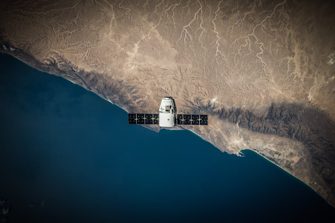
Nine satellites in three months. That's the pace Japanese startup Synspective maintained through spring 2026, launching its StriX radar constellation at a clip that would have seemed reckless a decade ago. The company deployed its ninth synthetic aperture radar satellite on May 22, lifting off from New Zealand's Mahia Peninsula , according to Synspective. The radar satellites detect ground movement down to the millimeter, even through cloud and darkness, with the expanding constellation aiming to deliver analysis to customers in less than one hour , industry publication African Mining Market reported.
The speed matters because the stakes have changed. Minerals like nickel, cobalt, copper, and manganese are core elements in manufacturing electric vehicles, batteries, computer chips, and solar panels , the EU Space Programme Agency noted. Finding them faster -- and monitoring extraction sites more closely -- has become a strategic imperative. Space-based sensors are no longer nice-to-have research tools. They're operational infrastructure.
Can Satellites Really Replace Boots on the Ground?
Not entirely. But they're getting close. Mining companies can now screen vast areas for mineral potential in days, slashing traditional discovery timelines and costs by up to 80-85% , according to Farmonaut, a satellite analytics provider. Hyperspectral imaging can identify more than fifty gold-related minerals from space in 2026, XRTech Group reported.
The technology works by capturing hundreds of narrow spectral bands -- essentially taking a photograph in hundreds of different colors simultaneously. Every mineral leaves its mark in the hyperspectral data, letting analysts spot deposits even when hidden under thin vegetation or soil , Farmonaut explained. Analysts can detect and map rock alteration and primary ore mineral signatures between trees, in dirt road tracks, on footpaths, and in upturned agricultural soils, identifying different minerals and their quantities from space , according to the Exploration Mapping Group.
Europe's Copernicus program has the potential to make mineral mapping and field work planning faster, safer, and more cost-efficient; Norwegian mining firm Kuniko partnered with Poland-based startup TerraEye to develop a remote sensing solution using Sentinel-2 imagery combined with other satellite data to detect spectral signatures of mineral deposits and identify vegetation stress patterns near legacy mining zones , the EU Space Programme Agency reported. Norway's harsh winters allow only a short seasonal window for on-site work -- satellite data extends that window to year-round.
What Happens When the Ground Moves?
Oil and gas operators have a different problem: the ground beneath their wells and pipelines won't stay still. InSAR data showed surface uplift up to 10 centimeters at a West Texas enhanced oil recovery field between January 2007 and March 2011 , researchers documented in a study of CO2 injection monitoring. That's enough movement to threaten infrastructure integrity.
Millimeter-accurate InSAR platforms identify subtle shifts in ground stability across multiple locations, eliminating the need for manual field inspections , according to geospatial intelligence firm Rezatec. Satellite visibility across tailings dams, waste storage facilities, and environmentally sensitive zones can detect structural changes, ground movement, and compliance risks early -- before escalation into regulatory or financial events , Arlula noted.
French mining group Eramet, the largest producer of high-grade manganese ore worldwide, collaborated with Italian remote sensing specialist Tre Altamira to improve space-based subsidence monitoring at active and legacy sites using Copernicus Sentinel-1 radar data and advanced InSAR techniques , the EU agency reported. The alternative -- deploying ground sensors across hundreds of square kilometers of remote terrain -- would cost orders of magnitude more.