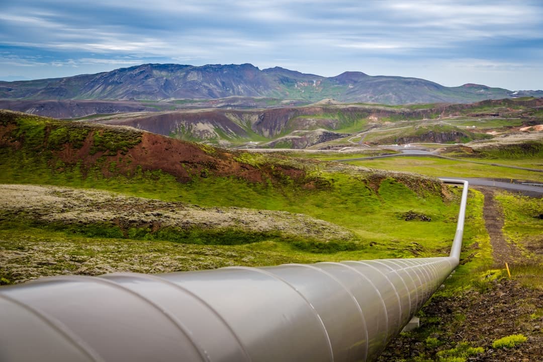
Energy Transfer now runs AI agents across 140,000 miles of pipeline in 44 states , answering questions in plain language without requiring SQL or a GIS interface. Ask where the nearest field office is within 50 miles of two midstream facilities in Texas, and the agent geocodes both locations, solves the route, calculates distance and travel time, and finds field offices within a 50-mile radius —all in seconds, according to demonstrations at the 2026 Energy Resources GIS Conference in Houston this spring.
That shift from specialist tool to conversational assistant captures the biggest change sweeping geospatial technology in energy this year. The 2026 Energy Resources GIS Conference brought together geospatial professionals from oil and gas, pipeline, and renewables for three days of sessions , and the dominant theme was clear: AI agents are moving from demo to deployment, and they're rewriting the economics of everything from pipeline inspection to renewable energy siting.
Can a Chatbot Really Replace a GIS Analyst?
Not replace—elevate. Marta Arias Alvarez, head of Global GIS Renewables at EDP, described the shift plainly: "Geospatial is no longer a support function, it is a strategic capability. We started building something deeper—a global geospatial culture" , she said at the conference. After hands-on training sessions, 76 percent of trained users described themselves as excited or more excited about the platform, having discovered capabilities they hadn't imagined .
The technology behind this isn't magic—it's what Esri calls agentic AI, and the company's new ArcGIS MCP server, releasing later in 2026, makes any agentic framework spatially aware . AI systems can rapidly analyze vast datasets like climate records, geospatial information, and regulatory constraints to identify the most promising sites for new wind, solar, or hydro installations , Microsoft noted in an April blog post on agentic AI in renewables.
With over 2,600 GW of renewable capacity stuck in interconnection queues across the USA, speed-to-market has become the single biggest driver of energy deployment, and the ability to rapidly evaluate sites and secure favorable interconnection positions provides critical competitive advantages , according to AWS research on agentic workflows for wind farm planning. The company estimates a 60% cycle time reduction—from months to hours—with 5x more scenario evaluations and a 2+% energy output increase through optimized layouts .
The real test isn't whether AI can answer questions—it's whether operators trust it enough to act on the answers. "If you can think of a question to ask, ask it," Energy Transfer's David Nemeth told the Houston audience. That confidence comes from agents that draw on GIS records, engineering documents, and live regulatory sources simultaneously.
What About the Drones and Satellites?
While AI agents handle the planning layer, the data feeding them is getting richer. Inspection drones equipped with thermal, LiDAR, or high-resolution RGB sensors detect issues like panel hotspots or corroded infrastructure before they escalate , according to Advexure, a drone solutions provider. Shell Pipeline Company deployed Intelligent Energy's IE-SOAR 2.4 system on a Harris Aerial H6 drone to conduct pipeline inspection flights , using hydrogen fuel cells that provide hours of flight time rather than minutes.
Satellites equipped with infrared and hyperspectral sensors can detect changes in thermal patterns, enabling early identification of leaks, and continuous monitoring ensures a rapid response, minimizing environmental damage and financial losses , SkyWatch reported. Satellite-based synthetic aperture radar (SAR) and multispectral imaging can detect shifts in terrain, unauthorized construction activity, and environmental changes that may indicate pipeline leaks, and by analyzing vegetation health and thermal anomalies, remote sensing can help operators pinpoint potential failures before they escalate .
The combination matters. Chevron is creating a standardized approach to managing the 22TB of imagery they've already processed, with an anticipated 39TB more to come, and their platform leverages the Spatio-Temporal Asset Catalog (STAC) standard to align with industry practices , according to presentations at the Energy Resources GIS conference.